|
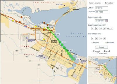
Use the Trajectory Tool to calculate and display a forward
or backward trajectory over a street
level map of the Corpus Christi area.
What is a trajectory?
A trajectory represents the hypothetical path of a
near-surface air parcel assuming the
parcel moves with the area-averaged
winds measured by the Corpus Christi
network of surface monitoring stations.
Simply put, the trajectory provides an
estimate of the path air traveled.
For a description of the data used to calculate a
trajectory and a summary of the
calculation methodology,
click here.
|